Wednesday, August 27, 2008

The West Coast

The West Coast

The West Coast south of Surat runs parallel to the great escarpment of the Western Ghats for its entire length of about 1,600 km culminating at Cape Comorin.
The straight looking coast is however quite jagged, marked by a large number of coves (small sheltered recesses in the coast) and creeks(small tidal inlets or estuaries of small streams). A large number of small streams descend from the precipitous Western Ghats and flow through the narrow coastal plain to open into the Arabian Sea.
Although the streams are small, some of them have formed spectacular waterfalls. The Konkan coastal plain is cliffy and there are several shoals, reefs and islands in the Arabian Sea. Mumbai was a large island but parts of the sea have been reclaimed in recent years to connect it with the mainland. There is a submerged forest near Mumbai which suggests that the sea level rose on the Konkan coast not long ago.

Gateway of India, Mumbai - Pic by Mridula Pai

The coastal plain is dotted with flat-topped hills. Transverse flat-looped spurs come down almost to the shoreline from the edge of the plateau and dip into the sea at Karwar, the northern part of Karnataka. These appear to be abrasional platforms, now dissected by the west flowing streams.
It is only on the Malabar coast that there are seen a number of lakes, lagoons and backwaters which form a noteworthy feature of the coast. These backwaters, locally called Kayals, are shallow lagoons or inlets of the sea, lying parallel to the coastline. The largest among them is the Vembanad Lake, which is about 75 km long and 5-10 km wide; it gives rise to a 55 km long spit. Cochin harbour is situated on its opening into the sea. These backwaters form important physical as well as economic features of the Malabar coast, affording facilities for inland water communication. The silt brought by recurring monsoon floods support large forests and plantations along the shores. There are remarkable mangrove swamps lining the coast.

Unspoilt, virgin beach near Kumta
Although the Ghats run parallel to the coast, the width of the coastal lowland varies. At Konkan it is about 50 to 60 km wide. From Goa to Kozhikode, the width of the coastal zone is more variable than in Maharashtra. It is about 40 km wide at the latitude of Goa and then suddenly narrows near Karwar where the Ghats almost meet the sea.

The Sahyadris dip into the sea near Karwar and form picturesque islands
To the south of 140N, the coastal zone now called Dakshina Kannada, widens once more to almost 80 km south of Mangalore. The coastal region after Kodagu, known as Malabar, is not more than 30 km wide up to the latitude of Kozhikode. From here it widens out to about 60 km near Palghat Gap.

Sunset at Maravanthe, Karnataka - Pic by Mohan Pai
South of the Palghat Gap the coastal zone constituting Travancore varies in width between 30-50 km.
The tropical monsoon climate covers the entire coastal belt. The Western Ghats greatly influence the climate and separate the west coast from the dry interior upland. The elevated Ghats obstruct the monsoon winds from South West and the orographic effect is considerable. Rainfall on the coast is extremely heavy during June-September averaging 100 inches (2,540 mm) with some of the wettest spots recording 300 inches (7,500 mm). The duration of the dry season gradually increases from two months in the southern parts of the Ghats to over eight months north of Mumbai.
Calicut Waterfront - Pic by Mohan Pai
The monsoon generally arrives towards the end of May at the southern tip of India; Tiruvananthpuram in the first week of June, in another five days it has already crossed Mumbai and by middle of June it is beyond Kutch.
Kerala is directly exposed to the southwest monsoon but also receives rains from the reverse (north east) monsoon. And for this reason the dry seasons towards the south are shorter.

A Coast of Maritime Legends

The maritime history of the West Coast of India predates the birth of Western Civilisation. The world’s first tidal dock is believed to have been built at Lothal around 2,300 BC during the Harappan civilisation near the present day Mangrol harbour on the Gujarat coast. Even before Alexander, there were references to India in Greek works and India had a flourishing trade with Rome. Roman writer Pliny speaks of Indian traders carrying away large quantities of gold from Rome, in payment for much sought exports such as precious stones, skins, textiles, spices, sandal wood, perfumes, herbs and indigo. It was the lure of spices that attracted traders from the Middle East and Europe to the many trading ports in Kerala - Calicut, Cranganore, Cochin, Alleppey and Quilon - long before the time of Christ. And it is believed that it was on a trading vessel plying between Alexandria and the Malabar that St. Thomas, the Apostle arrived in Cranganore in 52 AD and began preaching the Gospel and established seven Christian communities in Kerala.
From the earliest times, the West Coast had developed a considerable shipbuilding industry, specialised in building large vessels. There are several accounts of such activities including that of Marco Polo who has described the Indian built ships.
European interest in India has persisted since classical times and for very cogent reasons. Europe had much to derive from India such as spices, textiles and other Oriental products. When direct contact was lost with the fall of Rome and the rise of the Muslims, the trade was carried on through middlemen. In the late Middle Ages it increased with the prosperity of Europe. Spice trade was not solely a luxury trade - spices were needed to preserve meat through the winter (cattle had to be slaughtered in late autumn through lack of fodder in winter) and to combat the taste of decay. Wine, in the absence of ancient or modern methods of maturing, had to be ‘mulled’ with spices. This trade suffered two threats in the later Middle ages. There was the threat of Mongol and Turkish Invasion which interfered with the land route through Egypt, and there was the threat of monopoly shared between the Venetians and Egyptians.

Idalcao's Palace, Panaji, Goa - Pic by Mohna Pai
The Arabs controlled the spice trade with India since the end of the 12th century AD. During the 15th century Spain and Portugal, the then main maritime powers of Europe initiated a series of expeditions with Royal patronage. While one such voyage led to the discovery of West Indies by Columbus, another voyage brought the Portugese to India, the El Dorado. Vasco da Gama
Vasco da Gama set sail on July 8, 1497 with four ships and 170 men, rounded the Cape of Good Hope four months later, and reached Kappad twelve km north of Calicut on the Malabar coast of Kerala, on May 17, 1498. Calicut then was a busy sea port, where the Arabs and the Chinese met to exchange the products of the west and the east. Memorial to Vasco da Gama, Kappad beach near Calicut - Pic by Mohan Pai
The Moors in Calicut instigated the Zamorin against Vasco da Gama, and he was compelled to return with the bare discovery and the few spices he had bought there at inflated prices (but he still made 3,000% profit !). A force left by a second expedition under Cabral (who discovered Brazil by sailing too far west), left behind some men in a “factory” or trading station, but these were killed by the Moors in revenge for Cabral’s attack on Arab shipping in the Indian Ocean. Vasco da Gama was sent on a mission of vengeance in 1502, he bombarded Calicut (virtually destroying the port), and returned with great spoil. His expedition turned the commerce of Europe from the Mediterranean cities to the Atlantic coast, and opened up the east to European enterprise.
The Portugese eyed the Arab monopoly of Indian spice trade and tried to overthrow the Arabs. They succeeded after continuous battles with the Arabs for twenty years. Cabral, who led the second voyage established the first Portugese factory at Cochin. Francisco de Almeida, the Viceroy of Portugal (1505-15) built forts in Anjediva and Cannanor. In the year 1510, Afonso de Albuquerque captured Goa and developed it into a great trading centre, particularly for importing

Basilica of Bom Jesus, Old Goa - Pic by Mohan Pai
Arab horses. Apart from Calicut (1510-1616) and Goa (1510 -1961), the other Portugese possessions on the west coast included Bombay (1530-1664), Diu (1535-1961), Surat (1540-1615), Damao (1558-1961) and Bhatkal (1560-1637) .
In 1534, Sultan Bahdur Shah, the ruler of Gujarat ceded the island of Bombay to The Portugese and in 1661 it was given as a marriage dowry to King Charles II when he married the Portugese Princess, Catherine of Braganza. The crown ceded it to the East India Company in 1665.
During the fourth Mysore War (1799) between the British and Tipu Sultan of Mysore, Tipu was defeated and killed and among the other territories, the coastline of Karnataka came under the British rule. By the year 1818, the Marathas were completely subdued and their territories annexed by the British which also included most of the west coast of Maharashtra. The West Coast was now completely under the British regime with the exception of few pockets under the Portugese (Goa, Damao & Diu), the French (Mahe) and the Travancore coast.

Today, the west coast represents one of the most developed areas, both industrially and economically, of the country with four major ports - Mumbai, the largest port in the country, Marmugao, Mangalore and Cochin. Mumbai is the financial capital of India and also an important industrial hub with a population of over 12 million. A major Naval Base is taking shape at Karwar.
Apart from the major ports the entire coast is strewn with smaller harbours all along. It’s also a high population density area with Kerala having the highest population density in the country.
Surat southward, the coast is connected by National Highway 8 up to Mumbai and then by NH 17 - Panvel-Mangalore-Trissur. From Trissur NH 47 takes over and goes up to Kanyakumari. Konkan Railway, the west coast railway route was launched in January, 1998. Konkan Railway line connects Mumbai to Mangalore with a distance of 760km. It connects the three states - Maharashtra, Goa and Karnataka through the mountainous terrain of the Western Ghats. It goes through 92 tunnels and crosses nearly 1700 bridges and traverses through one of the most picturesque region of the west coast. Surat downwards the west coast is dotted with innumerable beaches interspersed by estuaries of the west flowing rivers, creeks and shoals.
The more famous beaches are that of Goa and Kerala which have been attracting considerable tourist traffic - both international and domestic.
The popular west coast beach destinations are as follows:
Maharashtra * Juhu * Marve-Manori* Alibag* Murud * Janjira * Kihim * Ganapatipule* Sindhudurg* Vengurla* Malvan

Goa
* Calangute * Baga * Colva * Anjuna * Vagator * Arambole * Palolem Karnataka
* Devbagh * Om & Kutle (Gokarna)* Murudeshwar* Malpe* Maravanthe* Ullal

Karwar shoreline - Pic by Mohan Pai
Kerala
* Bekal * Kappad * Varkala * Cherai * Kovalam* Alleppey

Friday, August 22, 2008

Conservation

Ecosystems Conservation and
Wildlife Protection

The protection of wild life has a long tradition in Indian History. Wise use of natural resources was a prerequisite for many hunter-gatherer societies which dates back to at least 6,000 B.C. Emperor Asoka’s edicts of the third century B.C. depicts one of the earliest conservation laws.
Centuries later, the Mogul emperors, sportsmen, men of action and born observers that they were, displayed a deep interest in the animal life of the country. The ethos of conservation and reverence for nature and wildlife as reflected in some of the exquisite images depicted in Indian art, painting, sculpture and architecture and use of animal fables from early literature like Panchatantra and Hitopa-desha are more relevant today than they were centuries ago.

Pre-colonial rulers had set up hunting reserves in many parts of India. In later years some fine sanctuaries were established in what was then British India, and in a few of the princely states. Well known examples are Bandipur in Karnataka, Corbett Park in Uttar Pradesh, Vedanthangal in Tamil Nadu.

Water hole at Muthanga Wildlife Sanctuary, Wayanad - Pic by Mohan Pai

But for the protection given to the Lion in Junagadh State and to the Great Indian Rhinoceros in Nepal and Assam, these two animals would have been exterminated long ago. Natural ecosystems have evolved over millions of years. A remarkable feature of the ecosystems is the basic stability of populations that they sustain, providing for a natural balance. Each ecosystem sustains a variety of organisms adapted to their environment and participating in a cycle of events involving interdependence between organisms and the physical world around them. Deforestation has been one of the major causes for the depletion of wildlife. Wild animals are left with no alternative but to adapt, migrate or perish. Widespread habitat loss has diminished the population of many species, making them rare and endangered.

There was a wholesale slaughter of wild creatures during late 19th and early 20th century during the colonial period. ‘In sheer numbers, over 80,000 tigers, more than 1,50,000 leopards and 2,00,000 wolves were slaughtered in a period of 50 years from 1875 to 1925’ (Mahesh Rangarajan). The beginning of the Second World War in 1939 resulted in enormous pressures on Indian forests for timber in early 1940s. Contractors moved in and large tracts of forest were cut down. They had guns, they hunted on a large scale. Few accurate records exist of the slaughter that took place.
The wood was even sent to Burma and beyond for building all that the British required. The forest service was fully occupied in this task.

After independence in 1947, a spate of ill-advised developmental schemes, an uncontrolled push for agricultural land, and unmonitored hunting wrought havoc on wilderness.
A series of river valley projects sprung up in prime wilderness areas. While this habitat devastation was taking place, the elite took to more sophisticated guns and tougher vehicles like jeep to make inroads into the forest and shoot thousands of tigers and other game. It was free-for-all. The British had left but the Indian elite was on a binge to shoot tigers. Shikar companies sprang up everywhere, enticing hunters from all over the world to the killing game.

With a growing concern for the fast dwindling wildlife, the Government of India in 1952 set up the Indian Board of Wildlife, as also state wildlife boards. Wildlife together with forestry, has traditionally been managed under a single administrative organisation within the forest department of each state or union territory, with the role of central government being mainly advisory. There have been two recent developments. First, the Wildlife (Protection) Act has provided for the creation of posts of Chief Wildlife Wardens and Wildlife Wardens in the states to exercise statutory powers under the Act. Under this act it is also mandatory for the states to set up state wildlife advisory boards. Secondly, the inclusion of protection of wild animals and birds in the concurrent list of the constitution, has proved the union with some legislative control over the states in the conservation of wildlife. The situation has since improved; all states and union territories with national parks or sanctuaries having set up wildlife wings.

The adoption of a National Policy for Wildlife Conservation in 1970 and the enactment of the Wildlife (Protection) Act in 1972 lead to a significant growth in protected areas network, from 5 national parks and 60 sanctuaries to 87 national parks and 485 sanctuaries in 2000.
The network was further strengthened by a number of conservation projects, notably Project Tiger, initiated in April 1973 by the Government of India with support from WWF and the Crocodile Breeding and Management Project, launched in April, 1975 with technical assistance from UNDP/FAO.

The large number of protected areas indicates concern for conservation. However, not all biogeographic provinces have received adequate attention, and vital habitats have been left unprotected. As many as 105 of India’s protected areas (out of a total of 571 parks and sanctuaries) are located in the Andaman and Nicobar archipelago alone. But the sanctuaries occupy only a small percentage of total mainland, barely 4 percent of mainland India. Many of them are small; 113 sites are less than 20 sq. km in extent, and some of these are too isolated from other wilderness sites to form viable habitats. Only 25 wildlife reserves in India cover more than 1,000 sq. km each.

Protected Areas of the Western Ghats

Western Ghats is an area of exceptional biological diversity and conservation interest, and is one of the major tropical evergreen forest regions in India. As the zone has already lost a large part of its original forest cover (although timber extraction from the evergreen forests of Kerala and Karnataka has now been halted) it must rank as a region of great conservation concern. The small remaining extent of natural forests, coupled with exceptional biological richness and ever increasing levels of threat (agriculture, reservoirs, flooding, plantations, logging and over exploitation) are factors which necessitate major conservation inputs.

The system of Protected Areas in the Western Ghats includes Nilgiri Biosphere Reserve, the first and the largest biosphere reserve in India, 13 National Parks and 45 Wildlife Sanctuaries. The largest national park is Bandipur with an area of 874 sq. km and the largest wildlife sanctuary is in the Anaimalai hills having an area of 841.49 sq. km the 58 protected areas together cover an area of 14,140.36 sq. km this amounts to 8.8% of the Western Ghats area. Of this, Bhadra, Bandipur, Periyar, Kalakad Mundanthurai are Project Tiger Reserves (Ministry of Environment and Forests, 1998). Some of the protected areas in Karnataka, Tamil Nadu and Kerala have also been designated as Project Elephant Reserves. The Bandipur national park in Karnataka is flanked by the Mudumalai sanctuary in Tamil Nadu, the Nagarhole park in the north and the Wayanad sanctuary in Kerala in the west thereby providing a continuous corridor and the largest habitat area to elephants.

Project Tiger

It is believed that there were more than 40,000 tigers in India some 80 years ago. Habitat destruction, rampant poaching and hunting brought about a sharp decline in their numbers. The National census of tigers in 1972 recorded the existence of only 1827 animals.


Considering the alarming endangered status of this majestic animal, the Government of India with support of WWF launched a scheme to protect the tiger called “Project Tiger” with nine sanctuaries declared as tiger reserves.
More tiger reserves were added in due course of time and today there are 28 national parks/sanctuaries under Project Tiger.
The main objective of Project Tiger was: “To ensure maintenance of a viable population of tiger in India, and to preserve, for all time, areas of biological importance as a national heritage for the benefit, education and enjoyment of the people”.

The then Prime Minister of India, Mrs. Indira Gandhi, a strong supporter of the Project, and of conservation in general observed, “The tiger cannot be preserved in isolation. It is the apex of a large and complex biotope. Its habitat, threatened by human intrusion, forestry and cattle grazing, must first be made inviolate”.

Project Tiger is a holistic conservation programme. The tiger cannot be saved in isolation. Saving the tiger involves the maintenance of a viable population of its prey species - the herbivore animals. For the herbivores to survive it has to be ensured that the vegetation of the forests is rich and varied. Thus saving tiger means saving an entire ecosystem.

The project is administered jointly by the wildlife departments of both the states and the centre. Project tiger, initiated in 1973, is one of the most comprehensive conservation efforts ever launched. At the apex of a complete biota, the tiger can be saved, not in isolation, but by making its habitat sacrosanct. Populations of rhinoceros, elephant, swamp deer, gaur and several other species have been preserved in this way.
Tiger Reserves in the Western Ghats

Project Elephant

Project Elephant, a scheme sponsored by the Government of India has designated 10 elephant reserves in the country of which 4 are in the Western Ghats. The four reserves also contain a mosaic of vegetation types and ecosystems harbouring high diversity of flora and fauna. For each elephant reserve a perspective plan has been provided which identifies the spatial integrity, important corridors, conservation issues and recommended action.

Dubare Elephant Camp, Coorg - Pic by Mohan Pai

Elephant Research and Conservation Centre (AERC 1998) has set up GIS database for 39 divisions comprising the four reserves in the Western Ghats. The AERC has also established a database on the demography and mortality of elephants and human elephant conflicts within the reserves.
Source: Asian Elephant Research and Conservation Centre (1998); ENVIS (1998)

Note: About 6,000 sq. km of these reserves are actually outside the limits of the Western Ghats yet contiguous. An estimated 6,822 elephants occur in this area.

Since the launch of the tiger conservation movement and the ‘Project Tiger’ in India, the tiger has made a dramatic recovery. Improvement in the quality of habitat and available prey has been considerable not only within the Project Tiger reserves, but also outside in Anaimalais and Nagarhole in the Western Ghats. Further to the managing the systems of Protected Areas and initiatives such as afforestation, eco-development, Joint Forest Management, the state departments of forests have mooted programmes that specifically address conservation of endangered vertebrates. Chief amongst these is the annual wildlife census organised by the forest departments. These censuses have enabled the closer monitoring of the status of some of the endemic and endangered mammals of the Western Ghats. Programmes on captive breeding and ex-situ conservation of such mammals and reptiles have also been coordinated by the forest departments through the zoos.

Wednesday, August 6, 2008

The Wildlife

Vanishing Forests...
Vanishing Species

“ This universe is the creation of Supreme Power meant for the benefit of all; Individual species must therefore learn to enjoy its benefits by forming part of the system in close relationship with other species; let not the other species encroach upon the other’s right”.
_ Isavasya Upanishad

Over the past century, India’s wildlife has dwindled to a mere fraction of its former strength and the flora and the fauna in the Western Ghats have not fared any better. Reduction in the forest areas means reduction of the wildlife habitat, which due to various factors has become fragmented. Conversion of forests into plantations, roads, railways, agricultural holdings, human settlements, hydroelectric project, irrigation dams, mining and location of industries in forest areas have all contributed to a very sizeable area of forests lost in the Western Ghats. The other factors which contributed to the depletion of wildlife are uncontrolled hunting, poaching and pollution.
Evergreen forests of Uttara Kannada -Pic by Mohan Pai

Deforestation has been one of the major causes for the depletion of wildlife. With the increase in human population and the growing need for resources, forests were cleared or encroached upon for agriculture, for human habitation, for grazing of livestock and for hydroelectric and irrigation dams. Thousands of square km of prime, evergreen forests have been submerged and destroyed in the Western Ghats for the sake of these development projects.

Lion-tailed Macaque

Industries also made heavy demand on forest resources such as wood for paper mills, exploitation of gums and resins, mining of forest land for minerals and ores, building materials, etc. Uncontrolled hunting of wildlife for pleasure, food, furs, skins, horns, tusks, etc. posed a serious threat to the survival of wildlife. The illegal trade in animal skins has been responsible for destruction of a large number of tigers, leopards, deer, fishing cat, crocodile and snakes as well as birds with beautiful plumage. Elephants were hunted for ivory. There are laws in the country to prevent such illegal trade, but these are often violated by unscrupulous elements, traders and exporters. Added to this is the practice of trade in exotic mammals, birds and reptiles and use of animals for biomedical research.


Pollution of air, water and soil due to various industrial activities apart from affecting humans affect the well being of animals also. Industrial effluents containing harmful chemicals discharged into the lakes, rivers and oceans adversely affect the aquatic life.
DDT and Dieldrin, used as pesticides also has major effect on birds, particularly sea birds. The egg shells of birds become thin, making them vulnerable to breakage due to the weight of the female while incubating them. Oil pollution is another serious problem affecting the seas through leakage from cargo ships and due to accidents.

Natural Extinction of Species
Despite, the seemingly complex and stable nature of ecosystems, a large number of animals which roamed the earth in early geological periods have become extinct. Extinction is a natural phenomena in the evolution of animals. Certain species disappear gradually as they are unable to withstand the competition from those that are better adapted. Sometimes a whole group of animals have become extinct as had happened with dinosaurs at the end of Cretaceous period, some 70 million years ago. Many mammals like mammoths and mastodons have also become extinct. Countless other forms of animals and plants have flourished and disappeared. We know about them from fossil records preserved in the crust of the earth. Extinction is irreversible. This has been part of the evolutionary process which has produced more advanced forms of life - a process that has occurred over a vast span of time over millions of years. The greatest contribution of Charles Darwin, who propounded the Theory of Evolution, in his logical explanation for evolutionary changes and appearance of new form of life - natural selection - the success of those organisms that are capable of adapting to the environment, to survive and reproduce.
Extinction of species has taken place over millions of years, long before the advent of man. Primitive man lived in harmony with nature and did not cause the extinction of animal species. However, the spread of civilization across the world and the progressive exploitation of Nature have had an adverse impact on wildlife. Hunting for animals, alteration of the environment, habitat destruction, pollution of the land, air and water, the human population explosion - all these have been responsible for the extinction of animal species in recent times. Since the 17th Century about 120 mammals and 150 birds have become extinct. The rate of extinction due to human interference has accelerated since the dawn of industrial age. In India, the Cheetah, the lesser one-horned rhinoceros, the pink- headed duck and the mountain quail have become extinct in the last one century. Many mammals and birds have become rare and endangered and many a natural range diminished in size with increasing deforestation, often confining the animals to small territories.

Animal Association in Hindu religion

The wildlife always had an association with the folklore and the legendary belief of India. Some 30 different mammals are mentioned by name in the Samhita (the four principal Vedas). Among them is the elephant, the favourite of Indra, whose sanctity is enhanced by the belief that eight elephants guard the eight celestial points of the compass. The langur or Hanuman monkey is held in veneration because of its association with the warrior monkeys who helped Rama in his war against Ravana. The lion is one of the many incarnations of Vishnu. The tiger finds mention in the later Vedic texts. The mongoose features in Mahabharata as a teacher of wisdom to King Yudhistira.

The deer is always associated with Brahma, the creator, and is the constant companion of Mahadeva. The wild boar is referred to as ‘Boar of Heaven’. It is told how in the primordial floods Vishnu taking the form of a boar, raised the submerged earth from the waters and supported it on his tusks.

Lord Ganesha, Hanuman, Narasimha, are deities worshipped all over India that have animal association. Different animals and birds are also venerated as vehicles of different deities. Nandi, the bull for Shiva, deer for Brahma, eagle for Vishnu, peacock for Saraswati, tiger for Durga, horses for the Sun God, and so on.

The earliest known record of measures taken for the protection of animal life comes from India. The oldest record which we have today is the Fifth Pillar edict of Ashoka the Great by which game and fishery laws were introduced into northern India in the third century B.C. In this inscription the Emperor had carved on enduring stone a list of birds, beasts, fishes and possibly even insects, which were to be strictly preserved. The mammals named are bats, monkeys, rhinoceros, porcupines, tree squirrels, barasingha stags, brahminy bulls, and all four footed animals which were not utilised or eaten.

Gaur
The edict further ordains ‘that forests must not be burned, either for mischief or to destroy living creatures’. Centuries later, the Mogul Emperors, sportsmen, men of action and born observers that they were, displayed a deep interest in the animal life of the country.

Their writings are full of descriptions, some in great detail, of the animals, the plants and the flowers of the country over which they ruled.
The animal life of the Indian peninsular region is characterised by the absence of many of the Indo-Malay species which are so abundant in the hill forests of the Himalayas. It is the home of the true Indian fauna of which the spotted deer, the nilgai, the blackbuck, the four-horned antelope, and the sloth bear are typical representatives. They are found no where else. Other species like the gaur, the sambar and the muntjac (barking deer) occur both in India and Malay countries.

The Western Ghats, in sharp contrast to the adjoining dry zone of the Deccan present a region of great humidity and heavy rainfall. The forests covering the western slopes are at times very dense and composed of lofty trees, festooned with perennial creepers. Bamboos form a luxuriant undergrowth. In parts of the range the forests are more open and the banks of clear streams running through them are covered with spice and betel groves.

Malabar Giant Squirrel - Pic by Vivek Kale

The Nilgiris, an offshoot of the Western Ghats, rise precipitously to form extensive grassy downs and tablelands seamed with densely forested gorges or Sholas. They are composed of evergreen trees with dense undergrowth.

Sholas similar to Nilgiris occur in Anaimalais, Palni Hills, Kudremukh and other south Indian ranges. They provide the main shelter to wild elephants, gaur and other large animals of these hills. The most interesting feature of the higher level forests of Nilgiris is their affinity to the Assam hill ranges.

Many of the trees found in these high ranges and some of the forms of animal life are common to both the areas. The forests of the Western Ghats and the south Indian hill ranges have a richer fauna than the remaining areas of the peninsular region.

Tiger
Among the species limited to these forests are the Nilgiri langur, the Lion-tailed macaque, the Nilgiri brown mongoose and the striped necked mongoose, the Malabar civet, and the spiny mouse. In the higher levels of the Nilgiris and the Anaimalais are found such characteristically Himalayan animals as the tahr, the pine marten and the European otter.

Endemic species of the Western Ghats

One hundred and twenty species of mammals are known from the Western Ghats of which fourteen species are endemic (found only in that area). The mammalian fauna of the Western Ghats is dominated by insectivores (11 species), bats (41 species) and rodents (27 species including porcupine). Few studies have, however, paid attention to the community structure and organisation of these small mammals in the Western Ghats, although there have been attempts to review our understanding of the status and ecology of smaller cats and lesser carnivores.

The Great Pied Hornbill

Rare, Endangered Species of the Western Ghats

Endangered animals are those whose numbers are at a critically low level and whose habitat is so drastically reduced or damaged that they are in imminent danger of extinction.

Slender Loris
In animal population, the tempo of decline accelerates after a gradual fall to a low level; once the local population of a species is much reduced its ability to recoup deteriorates progressively, and with the fall in numbers often the factors of depletion gain lethal potency.

Dhole (Indian Wild Dog) - Pic by Maximus

The International Union for Conservation of Nature and Natural Resources (IUCN) maintains a Red Data Book providing a record of animals which are known to be in danger. In India, the Wildlife (Protection) Act, 1972, provides four schedules categorising the fauna of India based on their conservation status. Schedule I lists the rare and endangered species which are afforded legal protection. It is revised from time to time representing the exact status of the species. At present estimate, 81 species of mammals, 38 of birds and 18 amphibians and reptiles are considered to be endangered in India. Conservation efforts have restored the status of some of these animals, like the tiger, rhinoceros, crocodile, etc.
Mating Frogs - Pic by Mohan Pai

Note: This chapter is condensed for the blog. The original chapter in the book gives detailed information about the endemic and other species

Saturday, August 2, 2008

The Tribals

.... may his tribe increase


The hill tribes or Adivasis (original inhabitants) as they are called, account for barely 5% of the area population in the Western Ghats. The tribals have coexisted with nature for centuries in quiet harmony with rich traditional knowledge and cultural life.


The changing times have told on the lives of the tribals and they have to make a hard choice; accept development with its positive and negative features or perish. In recent years with the reduction in forest area, imposition of forest regulations, construction of dams etc. the lives of the tribals have been highly disturbed. Hunger, ignorance and exploitation have forced them to leave their traditional forest living and take to crimes, migrate or seek employment in rural and urban areas.


Interior of a Toda Tribe Hut in the Nilgiris - Pic by Mohan Pai


The profiles of some of the major tribes of the Western Ghats are as follows:

The Tribes of the Nilgiris
Before the British opened up the high pastures of the Nilgiris in 1818 to the western civilisation, they were the preserve of four tribes: The Kotas, who gave their name to Kotagiri, made tools and music; the Badagas, who cultivated the land, the forest dwelling Kurumbas who collected honey and wood and also performed sorcery; and the Todas, who with their herds of sacred buffalo, provided milk and ghee. Toda Woman in traditional shawl - Pic by Mohan Pai
The Todas

The Todas have unique traditions revolving around their buffalo and their temples, which are dairies. Unlike their neighbours on the plains, in feature or build, they are tall athletic and well-proportion built and variously described as being Italian, Mesopotamean, Arabic or Jewish origin (it has been suggested that they are the lost tribe of Israel or descendants of Alexander's army). Their traditional dress is Roman type toga, covered by a shawl, and their language is Dravidian in origin, which supports the theory that they were part of the Dravidian flight southwards from the invading Aryans. The idea does not explain however, their physical appearance which is so different from their shorter neighbours on the plains below; when and why they sought refuge in the Nilgiri plateau must remain a mystery forever. The Todas consider they were created by gods to be the lords of the Nilgiris, and have been here beyond human memory. The Todas live in hamlets called munds. Their huts have an entrance less than a metre high, and closed by a solid block which slides across to close the entrance.

Toda Hut- Pic by Mohan Pai

Inside these bamboo and rattan structures is a raised sleeping platform, a fireplace and a cooking slab. Toda life centres around their cattle and dairy produce - milk, curds and ghee -forms the basis of their diet. When a tribesman dies, several of his valuable buffaloes are bludgeoned to death so he will have solace of their company and the nourishment of their milk on his journey to the kingdom of death.

Toda Temple - Pic by Mohan Pai

The Todas practice polyandry, a woman marrying all the brothers in the family; inbreeding and syphilis led to a long and steady decline in their numbers until recent times, when the advent of drugs and better medical care has helped stabilise their population. Today there are about 60 Toda settlements around Ooty.

Author at a Toda Village

The Soligas

The forest regions of Yelandur, Chamarajnagar, Nanjangud and Kollegal which include Biligiri Rangaswamy and Malai Mahadeshwara hill ranges in the southern part of Karnataka are inhabited by nearly 20,000 indigenous people called Soligas. The Soligas have co-existed with the forest for centuries in quiet harmony. Though primarily semi-nomadic, in recent years with the imposition of forest regulations, the Soligas have taken to more or less sedentary existence in small forest villages called ���podus��� or ���doddi��� or ���hadi���. To an outsider what impresses most is their traditional knowledge, cultural life and a life in harmony with nature.

Soliga Tribal Sttlement, B. R. Hills - Pic by Mridula Pai


The Soligas live in small huts at appropriate distance from water sources in fairly safe places to protect themselves from wild animals. All through the night they keep fire near their huts so as to ward off wild animals and protect them against cold.


The staple food of Soligas is ragi. The crop cultivation practices are quite primitive and their agriculture is known by the name ���kalakodu besaya���. The Soligas depend extensively on a number of non-timber forest products that are collected by the entire family.

The Soligas have their own medicine system known as ���naru beru aushadhi��� (roots and tuber medicine). They also depend on ���Thammadi��� (the priest) who worship their Gods and Goddesses and give them ���vibhuti��� (sacred ash).

The Soliga marriage is simple and by elopement. The boy and girl normally in their teens love each other and elope to the forest and may land up in some remote podu. The local Soligas provide them food and water. They are then brought back to their podu and a ���Nyaya��� (inquiry) is held. They are fined Rs. 12.50 and then blessed by the elders. A simple marriage ceremony is held thereafter involving a community feast. In some cases, however, no ceremony is held and the boy and girl live as man and wife in their podu. The Soligas appear to be acutely aware of their environment. Their concern for environment appears to be a product of their necessity and intuition. Years of close association with nature might have made them realise her secrets and inner life. Their life-line being forest, by sheer necessity too, preservation of forest has been ingrained in their culture.

Hallaki Vokkals of Uttara Kannada

Halakki Vokkals are confined to the coastal talukas of Uttara Kannada district of Karnataka. They are agriculturist living on farm lands located at the outskirts of towns that are sandwiched between the Western Ghats on the east and the expanse of the Arabian sea to the west. 75,000 Halakkis live in Koppas under direct control of their community heads. Mud walls and floors of their thatched huts are elaborately decorated with ���Hali���( White rangoli against black or red background). They have a rich folklore.

Their women (Gowdathis) are graceful, light in colour and very pretty. The hair are parted in the centre and brought back into a pendulous bun. Their nose, ears, necks arms and ankles are loaded with ornaments made of brass, copper and silver. They have a great fancy for blue, yellow and red beads, and wear them in large numbers around their necks in the form of strings. Women are extremely hardworking and a bridegroom has to pay ���Tara��� (bride price) to his father-in-law prior to the wedding.

The Siddis


Siddi schoolgoing children near yellapur- Pic by Mohan Pai
The Siddis are the descendants of African Negroes, who were brought to India mainly by Arabs, the Portugese and the Dutch. They are chiefly found in the forest areas of Ankola, Mundgod, Haliyal and Yellapur taluks. They live in small clusters constituting a distinct settlement of a village or independent settlement. Their occupation is agriculture and they also collect honey and go hunting. They speak Are-Marathi, a mixture of Marathi, Konkani and Kannada.
Tribals of Wayanad
Wayanad district is predominently a tribal district and the major tribes are : * Paniya * Adiya * Kuruchiya *Kathinayaka * Kuruma tribes.

The Paniya


Paniya Woman - Pic by Mohan Pai


The Paniya, a major tribal community in Kerala live in the hills of Wayanad. The headman of Paniya settlement is called ���Kuttan���, and the head of the family is ���Mudali���. The Paniya priest ���Chemmi��� wields authority over a group of settlements.

They practice monogamy and widows are allowed to marry. The Paniyas were bonded labourers employed by the planters.

Wayanad Tribal

The Adiyas

This is another of the slave tribes and the community is divided into subgroups called the ���Mandu���. The headman of the Mandu is called ���Peruman���. Polygamy is not a taboo among them and sex offender is not ostracized.

The Kattunayakans

This is a primitive tribe and the Kattunayakans literally live in jungles and are mainly engaged In collecting forest produce and honey. They do not mingle with other tribes. The headman is called ���Muthan��� whose decisions are always final. The Kattunayakans worship animals, birds, trees and other Hindu deities and firmly believe in black magic and sorcery.

The Kuruchiyans

Author with Wayanad Tribals

The Kuruchiyans are an agricultural tribal community and they are excellent archers who joined Pazhassi Raja in fight against British. They live in small though clean houses and do not encourage drinking alcohol except on festive occasions.

The Kuruma

The Kuruma tribals are supposed to be the original inhabitants of Wayanad. They are also good archers and had joined Pazhassi Raja in his fight against the British.

Subsistence economy in the Western Ghats is gradually dwindling for much of the hill dwelling tribals have sought employment in the local private and government sectors. The proportion of people classified as scheduled tribes is less than 5% in the four biodiversity rich states viz Goa, Karnataka, Kerala and Tamil Nadu. In fact the population classified as scheduled tribes in the states of Goa, Tamil Nadu and Kerala is hardly 1%.

Distribution of the Tribes of Northern and Central Western Ghats (Gujarat, Maharashtra and Goa)

Bhils are considered to be amongst the oldest settlers in the country. They derive their name from the Dravidian word ���Billu���, which means bow. Bhils are thus seen with bow and arrow which is their traditional weapon. They live in isolation, go for hunting, fishing, practice shifting cultivation and have escaped to a large extent the influence of Brahmania (upper caste) culture. This tribe was able to maintain political independence to a great extent and it remained the most turbulent amongst all the tribes.

Warli Tribe has become famous because of their traditional folk painting art. The Warlis are mainly residents of Thane district of Maharashtra spread out in the villages of Dahanu, Talasari, Mokhada, Vada, Palghara and extends up to the Gujarat border. Their tribal paintings are different from other folk and tribal art. They do not narrate mythology in primary colours as did the Madhubanis instead they are painted on mud, charcoal, cow dung based surfaces using only white colour, and are decorated with series of dots in red and yellow. Their paintings are influenced by the seasonal cycle as their life around them is directly reflected in the paintings.

Goa tribes include Gaude, Velip, Dhangar and Kunbi.

The Forests II

The Fast Disappearing Forests


“There was a time when meadow, grove
and stream,
The earth and every common sight
To me did seem Apparell’d in celestial light,
The glory and the freshness of a dream.
It is not now as it had been of yore;
Turn whereso’er I may,
By night or day, the things which I have
Seen I now can see no more.”

- William Wordsworth


As in many other tropical regions throughout the world, deforestation and forest degradation due to various factors such as extension of cultivated lands, grazing of livestock, extraction of forest products, commercial plantations, road and railway building, hydroelectric projects, atomic reactors and poaching continue unabated in the Western Ghats.

There have been various estimates and guesstimates about the loss of forest cover in the Western Ghats.
* A recent study (year 2,000) says that the Western Ghats, one of India’s most prestigious “biological hotspot” has lost one-fourth of its forest cover in the last 22 years. The study which estimated changes in forest cover between 1973 and 1995 in southern parts of the Western Ghats using satellite data reveals a loss of 25.6 percent in that period. The decrease in forest can be attributed primarily to increase in plantations and agricultural areas due to population growth with Kerala observing the most rapid changes.

The study also renews the debate that despite conservation measures adopted by various agencies, the rate of deforestation has accelerated in recent years. The data shows a whopping five fold increase in forest loss from the periods 1920-60 to 1960-90. The threat seems even bigger if one considers the fact that the study does not include forest degradation and habitat fragmentation that also eventually contribute to forest loss.

The southern stretch of the Western Ghats an area of approxi-mately 40,000 sq. kms, has experienced the most significant forest loss during 1973-95. There has been a loss of 2,729 sq. kms of forests with an annual deforestation rate of 1.16 percent.
(Study by ATREE, NRSA and University of Massachusetts, USA)

* According to U.N. Food and Agricultural Organization, the area alloted to plantations in India has been increasing at an average of 15 percent a year. At this rate, if all plantations were taken from existing forests - even the sparsely covered tracts - would be destroyed in less than a quarter century.


* An earlier report by TERI, New Delhi has made the following assessment:
Very little has been documented recently about the status of the forest cover in the Western Ghats, except that it seems to have declined between 1972 and 1985 at a rate paralleling that for India as a whole, which implies a loss of cover 2.4% annually. If we extrapolate from 1986 to 1989, this means a total loss of 34% from 1972 to 1989.


Still worse is the decline of the primary forest; the amount remaining seems to be no more than 8,000 sq. kms.
All but isolated pockets of original forest have been opened up by shifting, cultivation, allowing take-over by deciduous species and bamboo among other degenerate species.

* Another study reports (Menon and Bawa 1997): Nearly 40% of the natural vegetation in the Western Ghats disappeared between 1920 and 1990. Of these 76% were converted to open or cultivated lands and 16% to coffee plantations. The rest was due to conversion to tea plantations or hydroelectric reservoirs.

* Recent studies (Ramesh and Swaminathan 1999) indicate that in the Western Ghats of Karnataka, nearly 12% of the forests have been completely lost in the past two decades. During the same period in a region like Kodagu, coffee cultivation has increased by nearly 100% with a concomitant loss of 18% forest area.

* In the state of Kerala alone, in a period of 30 years, there has been a 47% decline in evergreen/semi-evergreen forests(Prasad 1998).
Less than a century ago 40 percent of India was forested. Large tracts of deciduous and tropical rainforests in the Western Ghats region were destroyed over the past century as the British expanded India’s railway network across the country. Then, between 1951 and 1976, some 15 percent of the nations’s land were converted to cropland and much of this came from natural forest.


Forests are strained by the increasing demand of their resources. As human and livestock population swell and forests shrink, the relationship between rural communities and forest has become increasingly precarious. Nearly 90 percent of the wood taken from the forests is used as fuel. And India’s forest provide fodder for some 100 million head of cattle that trample and denude under-growth as they graze.

Yet, India’s natural forests provide it with some extremely vital services: They protect topsoil from wind and water erosion, regulate temperatures, replenish aquifers, store genetic diversity, offer recreational relief and provide a number of products other than wood - including medicine and food.

Deforestation leads to several changes in the landscape. The degradation and fragmentation of forests, which generally precede deforestation, considerably affect the biodiversity of the region. In the Western Ghats, low elevation evergreen forests dominated by Dipterocarp constitute the most threatened habitat. Its continuum along the Western Ghats has been fragmented due to selective logging, increase in permanent settlements, and rubber plantations. Consequently, several typical low-elevation species have almost become extinct, several have become rare, and some species have taken refuge in the sacred groves.

One of the major forms of human interference to vegetation and flora in the Western Ghats is the building of dams. According to published sources, there could be hundreds including small and big dams, with Maharashtra alone having 631 dams(Nair and Daniel 1986).

Hill agro-systems in the Western Ghats are today dominated by estates chiefly of tea, coffee, rubber and monocultures of various tree species, including the oil palm that was introduced lately. Available estimate indicate that above an altitude of 1,500 m in the Western Ghats, there are 750 sq. km of tea plantations. A total ofnot less than 1,500 sq. km are under coffee and 825 sq. km under cardamom. It has also been highlighted that the Nilgiri district with a total area of 2,549 sq. km has around 1,000 sq. km under various forms of cultivation.

The impact of growing coffee in the Western Ghats has been studied to some extent. According to legend, the Arabica variety was introduced at the beginning of the 17th century by a Muslim pilgrim - Baba Budan, who brought seven coffee seeds from Yemen and planted them in his hermitage in Chickmagalur, Karnataka.

Coffee plantations were then introduced in Kodagu with large scale planting of coffee near Mercara. Growing in partial shade and the traditional system adopted by people have together favoured a greater diversity of native trees in the coffee dominated agro-systems of Kodagu.

Casurina plantations first appeared in Uttara Kannada district around 1868. Teak was first raised as monoculture in 1840. The first teak plantation in Kerala was established in Nilambur in 1844. Over the years, eucalyptus, cinchona, wattle, rubber, clove, cardamom, etc. have displaced extensive patches of natural forests throughout the Western Ghats.
Apart from introduction of commercially important plants, there have been invasions by a number of aggressive alien plant species during the past 200 years in the Western Ghats. Important among these are Lantana camara (var aculeata), Eupatorium odoratum, Mikania cordata, Parthenium hysterophorus, etc. Wattle (acacia) once introduced for the extraction of tannin in the higher hills is today a major threat to the Sholas and grasslands at these altitudes. The impact of these exotic plants has been subject of lot of debate.

Large number of ornamental plants of temperate origin have also run wild in the higher elevations of the Western Ghats. Hundreds of such species have been reported both from the Palni hills and from the Nilgiris. Human influences had an adverse impact on the diversity of flowering plants in humid forests of the Western Ghats. In the Uttara Kannada district lack of coppicing ability in conjunction with their use in the wood/matchwood industry has led to disappearance of several evergreen species.


With villagers concentrating on harvest of trees in the height class of 4 - 8 m as poles and commercial interests mostly extracting trees above 16m height, there was a reduction of around 45% in all height classes between the sites of low and high level disturbance.

Unique landscapes such as Myristica swamps gave way to cultivation of rice. Along with the swamps many species of the swamp trees disappeared locally. Selective logging in the Western Ghats has had differential influence on biodiversity. When evergreen forests are thus disturbed, the woody plant species diversity has shown a gradual decline. This has been accompanied by the selective loss of certain species of greater economic value and an overall reduction in forest biomass. Other organisms have responded to human disturbance of evergreen forests rather differently. Selective logging (consequently lower tree and canopy density) has locally increased the diversity of butterflies, lizards and birds in the Western Ghats.

Top Soil & Siltation

Deforestation leads to a very sizeable loss of the top soil. It is only the forests on the slopes that prevent the run-off which takes place after heavy rains and allow water to percolate into the earth. Loss of tree cover means the top soil that is held in place by the roots of the trees becomes loose and the run-offs carry the top soil to the bottom of the river causing siltation.

Where the top soil is lost, there can be no vegetation; most deserts for instance, are what they are because the wind has blown away the top soil, and no trees can grow there any more. We cannot really ‘create’ top soil, for top soil is the product of innumerable layers of leaf litter and dead vegetable matter which disintegrate and mix with the earth. It can take anything from 500 to 1,000 years to build up one inch of new top soil. No amount of money can buy new soil. 
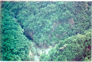
River Bhadra at Kalasa, Karnataka

Most loose soil from the hill slopes gets to a riverbed very fast, for in a heavy shower it travels down with the rain water or run-offs and settles down at the bottom of the riverbed, raising by a little bit, the level of the riverbed. This rising of the river bottom is called siltation and it is this which is the root cause of the floods which now we face every year. Floods are only one facet of the damage.

River Pravara near Wilson Dam, Maharashtra.

As the river bears with it its load of silt and mud out to the sea, harbours too are silted up, making it necessary to continuously carry out expensive dredging opera-tions.

The cycle of losing valuable soil, the siltation of riverbeds and consequent flooding has a strong adverse impact on the environment of the region. What is worse is that we are not only losing the invaluable soil, but large quantities of underground water as well.

River Valley Projects

The hydel potential especially of the west-flowing rivers is being utilised round the year by impounding seasonal waters behind high rise dams situated at strategic locations. To utilise the available head, water is channeled through penstocks to turbines in power houses. Penstocks in earlier projects as at Sharavathy in Karnataka and Khopoli in Maharashtra were on the surface.


Wilson Dam, Bhandardara, Maharashtra


In recent years penstocks have been laid in steep tunnels bored into rocky mountains. Idduki in Kerala and Nagjahri on the Kali have covered penstocks. The power houses also have gone underground as at Idduki and Varahi where they are within the mountain. Hydel generation is considered to be clean and relatively cheap. The environmental costs of hydel projects are, however, high though not easily quantifiable. The environmental issues of hydel projects are site specific but many are common. The following is a list of some common issues:


1. Submersion of large scale vegetation by the reservoir.
2. Degradation of forests due to quarries, roads, power lines and housing colonies.
3. Disturbance to wildlife during construction and change of the habitat after the construction.
4. Siltation of the reservoirs due to inadequate catchment area management.
5. Possibility of reservoir induced seismicity.
6. Cumulative impact of a series of dams and reservoirs in close proximity.
7. Displacement of people and lack of proper rehabilitation.
8. Impact on riparian communities when the pattern of river f low is changed or the water of one river basin is diverted to another basin.
9. Increase in salinity due to ingress of sea water, especially when water of a river is diverted to another basin.
10. Cumulative impact of all developmental activities in a particular region of the Western Ghats.


Submersion of Vegetation

The water impounded by the high dams generally submerge large tracts of evergreen forests of the western valleys. Linganamakki reservoir of the Sharavathy hydel project in Karnataka submerged 326.3 sq. km, mostly covered by luxuriant forests.
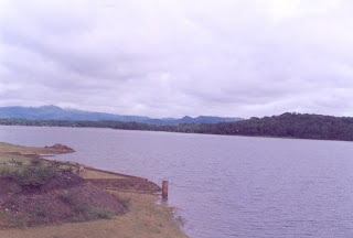
Harangi Dam Reservoir, Kodagu

In order to increase the quantity of stored water, auxiliary dams were constructed. The waters from Savehakkalu and Chakra further reduced the forest cover in Shimoga district of Karnataka. The Periyar basin in the High Ranges of Kerala has a series of 12 large dams which directly or indirectly resulted in destruction of about 4000 sq. km of rainforests and grasslands. Kali river with 6 major dams has submerged about 32,000 acres of prime forests in Uttara Kannada district. As hydel projects are being multiplied more forests are being lost. The compensatory afforestation programmes in arid areas do not compensate for the loss of rich evergreen and moist deciduous forests of the Western Ghats.

Colonies, quarries, roads and power lines

At peak construction activities, the work force at Sharavathy was around 50,000. Housing colonies were set up after denuding the surrounding hills. During the Kali stage, the township of Ambikanagar in Uttara Kannada was located in an area that still then was covered by dense forests. Before handing over the area to Karnataka Power Corporation, the forest department removed all the trees and handed over a totally denuded area. A similar denudation occurred at Ramanagara, the rehabilitation area for the Supa reservoir oustees .

Supa Reservoir on Kali Nadi, Karnataka


Degradation of wildlife habitats

The Western Ghats have a rich fauna. Herds of elephants, gaur and deer, flock of birds, many species of reptiles and amphibians, to mention a few, have inhabited these forests. The blasting of rocks, the rumble of heavy machinery, the incursion by humans have greatly reduced the fauna of the Ghats. These activities have also fragmented the forests to a large extent.
The change in river flow patterns so essential to spawning and migration of fishes has resulted in a drastic reduction of aquatic fauna. The lack of fish ladders in most dams confines fishes to particular areas and prevents normal movements. Studies have shown a marked reduction in aquatic fauna.
Siltation of reservoirs
The slopes of the Western Ghats are steep. The rainfall is heavy during the monsoon. Once the forest cover is lost and the grasslands are disturbed, run-off and soil erosion is high. Other activities in the catchment area increase the silt load. The Kali river valley schemes afford matter for a case study. In addition to 6 large dams, this area has nine active mining operations with scarcely any measure for controlling mine run-off and soil erosion from tailing dumps. Each of the mines contributes to the silt-load of the river. The water holding capacity of each reservoir is being reduced by this siltation.
Reservoir induced seismicity
Seepage and pressure built up by a large mass of water are known to induce seismicity. In order to monitor seismic movements and dam vibrations new techniques are being adopted. The double arch dam at Idduki has a number of sensors embedded in it. Most dams in the Western Ghats do not have such monitoring devices. Reservoir induced tremors and earthquakes in the Koyna region were felt several hundred km away from its epicentre. Had the dam collapsed, several downstream towns would have been washed away.


Cumulative impact

The environmental issues relating to hydel projects become more pronounced when a river has a series of dams or, when several basins in close proximity are taken up for power generation. The Sharavathy and Kali basins have a concentration of hydel projects. The series of dams and reservoirs alter the riparian ecology and biodiversity. The biota of a natural river bank cannot survive on the artificial shores of a reservoir. The cumulative impact of several projects has to be examined. As indicated earlier, the Sharavathy with its many dams and reservoirs destroyed extensive forests in Shimoga district. The Kali project has ruined a rich game sanctuary. The Koyna project resulted in seismic disturbances.

Mattupetty Dam Reservoir , Kerala

Silent Valley in the Western Ghats is a concrete example of abandoning the project due to prudence. The plans to submerge the Silent Valley caused a lot of agitation among conservationists. The scheme was to build a dam 390 ft high and 720 ft wide which would be used for the generation of 120 MW of hydroelectric power and would irrigate 5,000 acres of land. In this instance the conservationists were quite sure that the amount of damage that would be done by constructing the dam would be out of proportion to the advantages gained. The balance sheet was simple. The evergreen rain forests of the Silent Valley which would be submerged by the dam, was the kind which has evolved over thousands of years; there were few comparable areas of such forest left in India, and, once it went, it would mean that we had lost not only the forest itself, but hundreds of plant species which had not yet been studied. Fortunately the pressure from conservationists resulted in project being dropped. However, there is a recent move by the Government of Kerala to reopen the Silent Valley Project with a dam on Kunthipuza river.

Displacement and resettlement

Several studies have been made on displacement of people due to land acquisition and land submersion. The hydel reservoirs in the Western Ghats have displaced many thousand of people especially tribals and agriculturists. For example, the Kali project in Karnataka displaced 1,665 families, The Savehakkalu and Chakra projects displaced 227 families, the Varahi 1,361 families.

The trauma of displacement is made more painful by the inadequacy of the legal and financial provisions. Especially the displaced tribals go without any compensation. The socio-cultural environment of displaced communities is shattered. Their means of livelihood are undermined. Skills have to be learned once again as they shift from non-market economy to a competitive market based economy.

The responsibility of resettling displaced people is that of various departments of the State and Central Governments. Legislation to ensure justice to the displaced is weak and outmoded. There is a strong feeling among the displaced that “Peter is being robbed to pay Paul”.

Impact on riparian communities by changes in river flow

At the peak of the S-W Monsoon, the crest gates of the dams are opened to release excess water. The sudden release have affected the people living along the river banks. The situation can be so critical that the army has been called upon to rescue the marooned people. Sometimes the hydel projects are so designed that water from one river basin is diverted to another.
For example the double arched dam sealed the Periyar. The water in the reservoir is being diverted to the power house at Moolamattom. The tail race from the power house meets the Muvattapuzha river, leaving the Periyar with highly reduced flow. This has adversely affected the communities along the Periyar banks. A similar situation has resulted by the westward diversion of the waters of the eastward flowing Koyna river.

Increase in salinity due to ingress of sea waters

When there is reduction in flow of a river due to diversion of its water, the river in its lower reaches is not sufficiently flushed by the monsoon rains. Thus there is acute scarcity of fresh water at Ernakulam because of ingress of sea water after the construction of Idukki dam.

Cumulative impact of developmental activities

There are different activities going on simultaneously in the Western Ghats. Besides the hydel projects, irrigation projects are also implemented. Surface mining is taken up both within the forest and outside them. The controversial Kaiga Nuclear Power station, the only nuclear plant in a forest in the world is located at Kadri in the Kali river basin. There are traditional activities of forestry, agri-culture, horticulture. Plantations of coffee, tea, cardamom, pepper, rubber and ginger are being expanded. The cumulative effect of all these activities seriously threatens the ecosystems of the Western Ghats and undermines the resource base in this mountain range.

Irrigation Projects

In order to conserve seasonal waters of the east-flowing rivers, innumerable dams both big and small have been constructed in the Western Ghats and in the peninsular India. These are classified as large, medium and small irrigation projects. Only the large and medium irrigation works are being considered here. The Western Ghats merge with the Deccan plateau on the eastern side. They descend gradually from the ridge forming shallow valleys. Where the rivers flow through a narrow neck formed by the hills, dams are constructed to impound the water which is then conveyed over long distances by canals. The submergence of these valleys is of great consequence.

The moist deciduous forests are rich in timber species like rose-wood, teak, venteak. The fauna is varied and abundant. Many of the wildlife sanctuaries are located here. Plantations of coffee and tea, gardens of areca and pepper, orchards with a variety of fruit trees thrive well in these valleys. Flourishing agricultural communities have occupied the area and harvested cereals and pulses. Several studies have been carried out on the impact of these irrigation dams in the Western Ghat. Some of the environmental issues associated with these dams are common to hydel projects. Some are specific to the projects in the shallow valleys in the rain shadow area of the Ghats.


Deforestation and the Global Carbon Cycle

Carbon dioxide ( CO2) is the major gas involved in the greenhouse effect, which causes global warming. All the things that produce CO2 (like car burning gas) and the things that consume Co2 (growing plants) are involved in the “global carbon cycle”.

Tropical forests hold an immense amount of carbon, which joins with oxygen to form CO2. The plants and soil of tropical forests hold 460-575 billion metric tons of carbon worldwide. Each acre of tropical forest stores about 180 metric tons of carbon.

Deforestation increases the amount of CO2 and other trace gases in the atmosphere. When a forest is cut and replaced by cropland and pastures, the carbon that was stored in the tree trunks (wood is about 50% carbon) joins with oxygen and is released into the atmosphere as CO2.

The loss of forests has a great effect on the global carbon cycle. From 1850 to 1990, deforestation worldwide (including that in the United States) released 122 billion metric tons of carbon into the atmosphere, with the current rate being 1.6 billion metric tons per year. In comparison all the fossil fuels (coal, oil and gas) burned during a year release about 6 billion tons per year.

Releasing CO2 into the atmosphere increases the greenhouse effect, and may raise global temperature. The role of fossil fuels burned by cars and industry is well known, but tropical deforestation releases about 25% of the amount released by fossil fuel burning. Tropical deforestation, therefore, contributes a significant part of the increasing CO2 in the atmosphere.

Friday, August 1, 2008

The Forests

The Groves were God's first Temples


What we are doing to the forests of the world is but a minor reflection of what we are doing to ourselves and to one another.
__ Mahatma Gandhi


Although they receive vast amounts of rain, the evergreen forests of the Western Ghats are not rainforests in the strictest sense. In the tropical rainforests of the Amazon, for example, rain falls steadily and predictably throughout the year. This ensures that the niches which flora and fauna occupy are always available; and this in turn enables an enormous variety of species to survive. So the diversity of the monsoon forests in the Western Ghats cannot be compared with that of the Amazonian jungles.


Moist deciduous forests - Mahadayi Valley

The tropical monsoon forest contains trees of smaller stature than those found in the rainforest. The trees of the monsoon forest have a more open canopy than the rainforest, creating a dense, closed forest at the floor, or what we think of as a tropical jungle beneath. The thick surface undergrowth makes it difficult to navigate through the forest. Jungle growth is also found along streams, and in openings created by humans.

The southern Western Ghats has the best preserved and most extensive climax vegetation in the peninsular India. Some of the tropical moist forests in southern Karnataka, Kerala and Tamil Nadu are among the best representative areas of Indo-Malayan rainforest formations.

Forests - the mother of rivers

There is an umbilical connection between healthy forests and water regimes. Forests are nurseries and cisterns for our life giving rivers. Forest areas in the Western Ghats give birth to all the major and minor rivers of the peninsula. Most of the rivers spring from some unknown forest of the Western Ghats and yet there is a wholesale destruction and wanton pillage of forest areas that give birth to the rivers.
Because of the slope the rain water cannot stay to soak into the earth, it flows downhill rapidly taking some of the earth with it. This run-off on the hillsides will only be halted, and water will percolate into the earth where there is good tree cover. In fact a forest traps rainwater and channels it into underground streams. The fact that so many mountain springs have dried up in recent years is not due to some inexplicable form of bad luck. It is the direct result of the reduction in the number of trees on our hills.


Relationship Between Climate and Vegetation

The climate of the Western Ghats shows two rainfall gradients and a temperature gradient.

The West-East Gradient
The west-east rainfall gradient is determined by the effect of Ghats escarpment. The reliefs of the Ghats act as a barrier to the eastward movement of the cloud masses brought by the summer monsoon rain-bearing winds of the south-west monsoon.

Bisale Ghat, Karnataka - Pic by Mohan Pai

These masses bring prodigious amount of rainfall over the western slopes of the Ghats. For instance in Agumbe (height 645 m) which is situated at the edge of the Ghats, the mean annual rainfall is 7,460 mm, and in some years it exceeds 12,000 mm in only 130 rainy days. Overall the western slopes receive 2,000 to 7,500 mm of rainfall. Once this obstacle is crossed, the rainfall decreases rapidly to <800mm>

Aerial View of Evergreen Forests - Mahadayi Valley

The South-North Gradient
An important feature of the Western Ghats is that they form more or less continuous chain of hills with a latitudinal extent of almost 12 degrees. This has few parallels in the tropical world(eastern part of Madagascar and Queensland in Australia). The monsoon, the very pulse of India, adds yet another dimension : the duration of the dry season gradually increases from two months in the southern parts of the Ghats to over eight months north of Mumbai. This gradient is determined by the arrival and withdrawal of the summer monsoon. The monsoon generally arrives towards the end of May at the southern tip of India, in the first week of June at Tiruvananthpuram, five days later it reaches Karwar, in another five days it has already crossed Mumbai and by middle of June it is beyond Kutch. Thus it takes only 10-15 days to cover the Indian peninsula from 80 N to the Tropic of Cancer.

The monsoon begins to retreat by the end of September in north India but it takes nearly 15 days for the front to withdraw from Kutch to Ratnagiri which it reaches in the beginning of October, in another 15 days it covers 400 km, the distance separating Ratnagiri from Coondapur. The front passes through Mangalore at the beginning of November and Kozikode in a fortnight, and reaches Kanyakumari only in early December. Thus the withdrawal is spread over a period of nearly two and a half months. The advance and specially the gradual withdrawal of the monsoon leads to a reduction in the rainy period from south to north and consequently a concomitant lengthening of dry season.

This gradient is one of the key factors for understanding the variations in the floristic composition along the Ghats. The distribution patterns of the species clearly show that many species cannot thrive under prolong dry periods. Thus several species are not found north of the Shencottah-Ariankavu pass, while others disappear beyond the Palghat Gap. Hence, the number of endemic evergreen species which are generally confined to a moist environment diminishes from south to north in the Western Ghats. In the northern part of the Ghats, this gradient also determines the climatic limits beyond which the evergreen formations gradually give way to deciduous forests. Evergreens survive only under special edaphic conditions or at the higher elevations, where dew and mist provide additional moisture.

Temperature gradient
The temperature gradient is mostly related to increase in altitudes. The influence of the decreasing temperature with increased altitude is explicit only in those regions of the Ghats where the altitude is sufficiently high i.e. from 700 or 800 m upwards. Generally the mean temperature of the coldest months ranges from 230C at sea level to 110C at 2,400 m. However, it must be noted that for the same elevation, the temperature may differ considerably from one place to another, depending on exposure or slope. This decrease in temperature influences the kinds of changes: a) structural change from tall forests (canopy higher than 30 m) to stunted forest (canopy lower than 20 m or sometime 15 m). b) floristic change as some species are unable to adapt to very low temperatures which are optimal for others.

Uttara Kannada Forests

Climatic Variations and Endemics

The high degree of endemism in the evergreen forests of the Western Ghats can be attributed to the isolation of the Ghats from other moist formations and the prevailing drier climatic conditions in the surrounding areas. This isolation seems to have facilitated the process of speciation (formation of new biological species) leading to the phenomenon of vicariance between sister species derived from a common ancestor, one of which thrives in the evergreen forests of the Ghats and the other in the adjacent dry regions (for example Diospyros assimilis in the moist evergreen forests and D. Ebenum in dry forests).
South of Kodagu, the Western Ghats are comprised largely of high ranging hills with several enclaves which formed ideal refugia for certain species when the climatic conditions became drier . Within the Ghats, the variation in the degree of endemism is mainly determined by
a) the increase in the number of dry months from south to north and
b) the decrease in the temperature with increase in altitude. These two gradients also explain the numerous cases of vicariance encountered within the evergreen continuum. Local topographic variations add another dimension to the floristic diversity and endemism.

Bamboo Brakes - Muthodi, Karnataka - Pic by Mohan Pai

Vegetation Types
In the Western Ghats, based on the ecological factors and floristic composition, 4 major forests and 23 floristic types have been distinguished. These types are closely related with the temperature and rainfall regimes. Wet evergreen, dry evergreen, moist deciduous and dry deciduous are clearly distinguished by the mean annual rainfall, whereas low, medium and high elevation wet evergreen types are distinguished by the decrease in minimum temperature with increasing altitude. In addition to forests, high altitude grasslands are another unique ecosystem in the Western Ghats.
Wet Evergreen Forests
Wet evergreen forests are mostly confined to the windward side of the Ghats where the rainfall exceeds 2,000 mm.
By taking into account the distribution pattern of certain characteristic species, which reflect the climatic variation, the forests are further subdivided into 15 main floristic types - low (0 - 800 mm), medium (600 - 1,450 mm) and high (> 1,450 mm) elevation types. In the low elevation type, they are tall dense forests with four strata and emergent layer - canopy height often reaches 35 - 45 m.
The deep valleys on the western windward side nurture closed canopy, stratified evergreen forests. These are arranged in a series of tiers. Each tier receives a different amount of light; the tallest trees are bathed in perpetual sunlight, smaller trees and shrubs receive dappled light. The forest floor is almost in complete darkness. The canopy is supposed to be closed because the contiguous crown of tall buttressed trees merge to form a veritable roof.

Occasionally, giant trees termed as emergents push through the canopy to obtain dominant position. Light, temperature and humidity differ at different heights beneath the canopy. Two or more strata of shade loving trees find the appropriate level at which light intensity and relative humidity are best suited for their metabolic activities.
The density of growth in these hot and humid jungles is so great that over 70 tall trees can exist in one hectare. These trees may be 35-45 m high and have evolved small narrow leaves to minimise moisture loss through evaporation. The lower growing plants have larger leaves in order to maximise the benefit of the little light that manages to penetrate. At every level, leaves tend to be narrow with drain-like tips so that the monsoon water flows off efficiently. This makes it possible for the leaf to remain relatively dry and breath.
The forests are in leaf throughout the year and hence termed evergreen. These trees shed their leaves at a slow and steady rate throughout the year, which results in continuous decay and decomposition on the forest floor which is full of leaf litter and decaying wood on which mushrooms, lichen and fungi thrive. In the relative gloom of the forest floor herbs are frequent with good representative of gingers and orchids. Climbers and lianas supported by sturdy trees, spiral towards the canopy in search of better light and fresh air.

Dry Evergreen Forests

The steep eastern slopes of the Ghats where the rainfall is less than 1,500 mm harbour dry vegetation types. However, in the relatively moist valleys and along streams, forests are evergreen and distinct in floristic composition with its counterpart on the western side. Physiognomic structure of these forests varies according to moisture level of the soil. Generally they are short forests, with a canopy seldom higher than 12 m, and with two strata.
Moist Deciduous forests
Moist deciduous forests, which are in primary nature, are found in the rainfall zone of 1,500 mm to 1,800 mm; as a transition between wet evergreen and dry deciduous forests. Large extent of these forests occurs in the Wayanad, Mysore and Karnataka plateau. Moist deciduous forests also occur within the potential area of wet evergreen formations, where the rainfall is more than 2,000 mm. Its very presence in the zone indicates their secondary nature after a possible degradation of original wet evergreen forests. On the leeward rain shadow side as well as on the coastal lowlands there are fairly long dry periods. Moist deciduous trees survive the rigours of the dry months by shedding all their leaves simultaneously to avoid loss of water through transpiration.
During the leafless period the trees carry on their reproductive cycle by spectacular flowering followed by abundant fruiting. With the pre-monsoon showers, a flush of fresh leaves appears to herald the beginning of a fresh annual cycle. A number of good timber trees are found in these open canopy forests.

Dry Deciduous forests

Dry Deciduous forests are confined to the rain shadow areas of the Ghats. Based on the topography of the Ghats, floristic types of dry deciduous formations vary.
Grasslands (The Sholas)
In the Western Ghats natural grasslands are found above 1,800 m in Bababudangiris, Kudremukh, Nilgiris, Anaimalais, Palnis and Cardamom hill ranges. The grasslands which are also called as shrub savannas or the Sholas are characterised by number of herbaceous and shrubby species mixed with grasses.

Kudremukh Sholas - Pic by Mohan Pai
The Shola are subtropical montane evergreen forests that harbour species which have outlasted the gradual climatic and ecological changes since the last glaciation 30,000 to 20,000 years ago. The exact course of evolution of the Sholas which is a mosaic of grasslands with stunted evergreen vegetation in sheltered hill folds is not certain.
One point of view attributes the expansion of grasslands to recurrent fires brought in by the early inhabitants. Using fire they cleared forests and these cleared areas became grasslands. Another point of view attributes the grasslands to climatic conditions in those elevations preventing emergence of closed canopy, multi-tiered vegetation.
Plant communities on reaching grass community level are arrested from proceeding further in succession.

Grasslands then become climatic climax. It is possible that the climax vegetation i.e. montane evergreen forests, did occur elsewhere along the crest line earlier but have been slowly regressing and receding due to climatic changes particularly due to the post Pleistocene dessication and warming. These Pleistocene refugia are mostly restricted to the Western Ghats south of Kodagu and are among the most endangered ecosystems in India.
The grassy meadows of the Sholas are at their best towards the end of south-west monsoon. Thousands of gentians, orchids and violets stud the carpet of grasses with a rapid succession of flowers. The trees are generally stunted and do not form strata. A stream generally runs through these forests. There is a thick layer of humus that holds water and filters it into the limpid streams. The stream waters the forest and the forest protects the streams.

Seaside Vegetation & Mangroves

The marshy areas, the swampy places where the sea comes in high tide, or where a river finally empties itself into the ocean, these are the places where many kinds of fish come to spawn. Often these areas are very large; trees do not grow here, for salt water washes over them, or floods them regularly; the loose muddy sand shifts easily, and the only plants which can take hold are mangroves with their long spreading roots. The mangrove bushes prove their worth during a storm, for they break its force; in a rough sea the mangrove belt acts as a buffer and prevents erosion and keeps the coastline in tact.

The mangrove vegetation has to survive on the scorching, shifting and saline sands. Trailing stems, fleshy leaves, salt excreting glands are some of the aids for their survival.

The mangroves in the slushy estuaries have special features to overcome the difficulties of their habitat. The mangrove trees and shrubs anchor themselves against the push and pull of the tides by stilt roots.
Air in the marshy soil is meagre. The trees often turn their breathing roots upwards in search of fresh air. The seedlings of mangrove trees remain attached to the parent plant until they have a chance of surviving on their own. They fix themselves like darts in the marshy saline slush to avoid being washed away by the sea until they have a chance of surviving on their own.
If we remove the mangroves, the coast is exposed to the danger and damage from storms and rough seas.

A number of factors have been responsible for the depletion of wetland areas, mainly the mangrove forests, along the coasts. Intensive aquacultural development, deforestation, pollution from tankers, domestic waste, agricultural run off and industrial effluents are some of the factors. Most of the surviving mangroves are now confined to West Bengal and the islands in the Bay of Bengal.

Sacred Groves and Sacred Trees

Many traditional societies all over the world revered and worshipped nature and considered certain plants and animals as sacred. India has a long tradition in protecting nature - both plants and animals considered as sacred. Forests have been the lifeline for tribals and other forest dwelling communities since ages. Communities all over India followed the practice of setting aside certain patches of land or forest dedicated to a deity or village God, protected and worshipped.

The forest deities are generally of a primitive nature. Sometimes in the form of unshaped stone lumps smeared with red paint - Kalkai in the Konkan, Kenchamma in South Kanara. They are amongst the fiercest of deities; and breaking even a dead twig in a sacred grove is sure to invite the wrath of the deity. Sacred groves are to be found all over the country and abundantly along the Western Ghats and the west coast and in several parts of Kerala, Karnataka, Tamil Nadu, Maharashtra and Goa.

Sacred groves ranged from 50 hectares or more to a few hundred square meters. Some sacred groves have remained in tact till recent times as in the Dakshina Kannada and Udupi districts of Karnataka. These pockets have contributed to the preservation of tropical biological diversity, for several new species of plants which have disappeared from everywhere else have been found to be preserved in the sacred groves.

Sacred groves in different areas are locally known by different names. In Kerala there are hundreds of small jungles called Sarpakavu. There are the Ayyappan kavus dedicated to Lord Ayyappan, the most famous of which is Sabrimala. In Maharashtra, they are known as Devarai, Devarakavu in Kodagu, Kavu in Kerala and Kan in Uttara Kannada.

In spite of the depletion of forests, some sacred groves still remain in-tact. The sacred groves have contributed to the conservation of nature though in a small measure. There are also sacred ponds attached to temples in many parts of India.

Some of these have been responsible for the protection of certain endangered species of turtles, crocodiles and the rare fresh water sponge.
Many plants are considered sacred from historical times - the peepul tree(ficus religiosa), the banyan tree(ficus bengelenses) and khejadi tree which were traditionally revered and therefore never cut. More than a hundred such species are considered sacred.

These include sandalwood tree, betel nut palm, coconut tree, juniper, champak, lotus and tulsi. This traditional and cultural attitude, though based on religious faith, has made a significant contribution to the protection of various species of trees and plants in India.

Author in the Sahyadris